


LA Metro - Official
4.576.00 Reviews
App Specs
- Version
- 5.194.1.1788
- Updated On
- License
- Free
- Downloads
- 10,000+
- Developer
- TAP LA
- Categories
- Travel & Local
- Platform
- Android
Screenshots
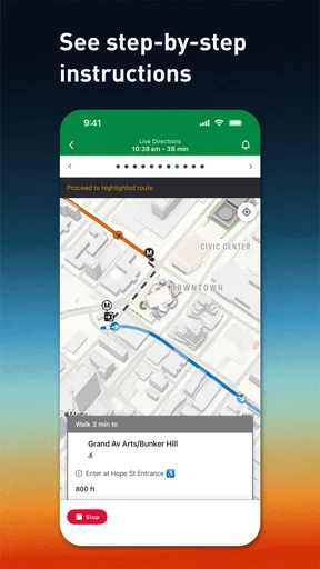
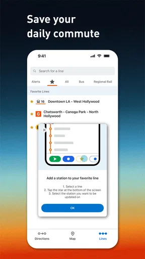
 Analysis by AppCompare
For a trip across Los Angeles, the hardest part is often not choosing a destination but working out which train or bus will actually get you there without wasting time. LA Metro - Official is built for that practical problem. I used it as a travel and local app from TAP LA, and my overall impression is that it is most useful when you want Metro information in one place rather than piecing together a route from several sources. It is free, rated for Everyone, and its focus is refreshingly narrow: planning a journey and following Metro service information as your trip unfolds.
That narrow focus matters. This is not an all-purpose travel planner trying to cover flights, hotels, walking tours, rideshares, and restaurant bookings. It is a public-transit companion for people who need to understand a Metro journey. In my experience, that makes it easier to approach when I am already standing at a station or trying to decide whether public transport is realistic for a particular appointment. It also means that people expecting a complete city-navigation replacement may find its scope limited.
How the app feels to use in real travel situations
I find the app most useful when I treat Metro information as something to check at two distinct moments: while shaping the trip and just before acting on it. That approach helps me use live updates to make a concrete choice—whether to set out, wait, or rethink the route—rather than staring at changing details without a plan. The next section looks at how that habit fits into an ordinary journey.
Readable information and a navigation flow that rewards preparation
The best way to use LA Metro - Official is to open it before leaving, not only after something has gone wrong. I would first check the route for the complete journey, then look again shortly before boarding. That small habit helps separate two different jobs: deciding how to travel and checking whether the service is behaving as expected. Treating those as separate steps makes the app feel less hurried and reduces the chance of making a decision from an old screen.
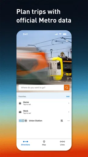
The app’s purpose is immediately understandable. Its store summary centers on trip planning and real-time Metro information, so I do not have to guess whether it is intended for ticket purchases, sightseeing suggestions, or general city discovery. That clarity is valuable for occasional riders who may not know the system well. Instead of beginning with a large collection of unrelated travel tools, I can concentrate on the route, the ride, and the information that affects the next decision.
For readability, the most important test is whether I can identify the next action quickly: where to start, which service to use, and whether the expected arrival information still makes sense. I found that the app works best when I give myself a moment to read the whole route rather than tapping through it while walking. Transit names can be easy to confuse when I am distracted, especially if I am changing lines or moving between a station and a street stop. A deliberate check before setting off is more reliable than trying to interpret every detail in motion.
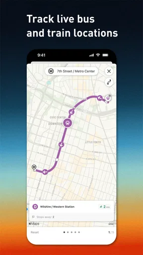
One useful workflow is to take a mental snapshot of the journey before leaving. I note the first boarding point, the transfer location, and the final stop. Then, once I am traveling, I use the live information to confirm the next part rather than repeatedly rebuilding the entire trip. This is a small but important distinction: a route planner helps me understand the structure of the journey, while live tracking helps me react to changes. Using both in that order keeps the screen from becoming a source of unnecessary decisions.
Worth Reading Before You Choose

Switching to Android Auto Means Rethinking Your Driving Routine

Google Calendar Makes a Crowded Week Easier to Manage

Baby Panda World Brings Quick Play to Modern Phones, but Its Game Library Feels Busy

ESPN’s Live Game View Makes Following Close Games Easier

QuizzLand Review: A Good Fit for Short Trivia Breaks, Not Every Player

Basketball Stars: Multiplayer Is Fast, but Can It Recover When Matches Go Wrong?
The app has a 4.5 average from around 160 ratings, which suggests that its focused approach is working for many people, although a rating alone cannot tell me whether it suits a particular travel style. I would not judge it by the same standards as a broad mapping app. A general map may be better for comparing walking, driving, cycling, and rideshare options side by side. LA Metro - Official makes more sense when Metro is already the main option and I want information centered on that network.
What different users may need from the interface
People with different visual, cognitive, or reading needs may experience the same route information very differently. I appreciate that the app’s limited purpose can reduce cognitive clutter: there are fewer reasons to wander into unrelated screens. For someone who becomes overwhelmed by a general travel app filled with recommendations and alternate transport modes, a Metro-focused tool may be easier to understand. The trade-off is that the user still needs to interpret transit terminology and keep track of transfers.
I would recommend enlarging the device text or display settings where possible and checking whether route details remain comfortable to read before relying on the app during a busy trip. I would also avoid assuming that live information alone makes a journey accessible. Real-time updates can tell me that a service is changing, but they do not automatically explain whether the alternative is physically manageable, easy to locate, or suitable for someone who needs extra time. That judgment still belongs to the traveler.
For users who prefer a slower, more predictable process, the app is best paired with a written travel plan. I might record the station or stop where I need to change, the direction of travel, and the final destination in a note. This is not a criticism of the app; it is a sensible backup for anyone who finds it difficult to keep several transit details in working memory. It also helps if the phone becomes hard to use because of glare, noise, low battery, or a crowded platform.
For users with hearing-related needs, visual service information is especially important, but I would still treat the app as one part of the information chain. A notification or update on screen may be easier to access than an announcement that is difficult to hear. At the same time, a visual message may require careful reading at exactly the moment when a platform is busy. Looking at the information before reaching the station, then checking it again in a safe position, is more practical than trying to process it while boarding pressure builds.
Motor, sensory, and attention-related considerations
Transit apps are often used under awkward physical conditions: one hand may be holding a rail, the phone may be exposed to sunlight, and the user may be moving through a crowd. In that setting, even a clear route can become difficult to operate. I found that LA Metro - Official is more comfortable when I prepare the journey before entering that environment. The less tapping I need to do on the platform, the better the experience becomes.
Someone with limited dexterity may benefit from avoiding repeated route edits once the journey has started. I would plan the main trip in a calm place, keep the phone accessible, and use only the most necessary checks while traveling. This is also useful for people with tremors or fatigue, because it reduces the number of small, precise interactions required at a stressful moment. The app is a support tool, not a reason to keep looking down while walking.
Sensory overload is another realistic concern. Stations combine announcements, movement, signs, vehicles, and people asking for space. The app can help shift some planning away from that environment, but it cannot remove the sensory demands of the journey itself. I would use it to establish the route in advance, then rely on physical signs and staff assistance when the surroundings become too distracting for safe phone use.
For users who need extra time to move between services, the important trade-off is between a theoretically efficient route and a manageable one. The quickest suggested journey is not always the best personal choice if it involves a rushed transfer or a difficult station environment. I would use the app to understand the available route, then choose the option that leaves room for slower walking, mobility equipment, fatigue, or uncertainty. Real-time accuracy is helpful here because it may reveal that waiting for a later service is preferable to forcing a tight connection.
A traveler with a mobility device, a visual impairment, or another access requirement may need information beyond a basic route and arrival update. In that situation, I would not assume that the app can answer every station-level question. Its strength is helping me organize Metro travel and monitor service information; it should not be treated as a complete personal accessibility assessment. If a journey depends on a specific elevator, platform arrangement, or assistance process, I would verify that detail through the appropriate official support channel before leaving.
Using it when the day does not go to plan
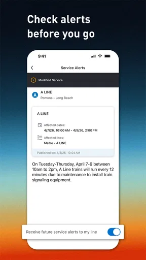
The most convincing use case is an ordinary weekday appointment. Imagine leaving home for a medical visit, class, or work shift when the planned Metro service is no longer running as expected. I would open the app before walking to the station, check the current information, and decide whether to continue, wait, or reconsider the route. That is more useful than discovering the problem only after reaching the platform, particularly for anyone who finds unexpected changes physically or mentally exhausting.
Another good scenario is meeting a friend in an unfamiliar part of Los Angeles. I can plan the Metro portion before leaving, identify where I need to finish the ride, and use live information to avoid assuming that the timetable is unchanged. If the friend asks where I am, I can give a more useful answer than “I am on the way”: I know which part of the journey I have completed and what remains. This makes coordination easier without turning the app into a social or messaging tool.
Visitors may also appreciate the focused design. A tourist who already knows the destination but is unsure how Metro fits into the day can use the app to make public transport feel less abstract. The limitation is that it does not replace broader orientation. I would still want a general map for the final walk, a clear destination address, and a backup plan if the last portion is confusing or unsuitable. The app is strongest in the transit segment, not as a complete guide to every doorway.
For a commuter, the value is less about discovering a route and more about checking whether the familiar routine is worth following today. That is where real-time information can save a wasted walk or an unnecessary wait. However, regular riders should avoid becoming overconfident. Live information is useful for decisions, but no app can make every operational change predictable. I would keep an alternative in mind when arriving late would have serious consequences.
Where the experience still has friction
The biggest limitation is the boundary of the product. Because it is a Metro-focused app, it is not the ideal single tool for a journey that depends equally on walking directions, another transit operator, cycling, rideshare, and driving. A broad mapping app may offer a better comparison when the question is not “How do I use Metro?” but “What is the best way to reach this place today?” I would choose LA Metro - Official when Metro information is the center of the decision, not when I need every transport option ranked together.
There is also a human cost to real-time changes. Accurate information is valuable, but it can create more decisions: wait, transfer, reroute, or abandon the trip. For a user with anxiety or limited energy, a stream of changing information may feel less reassuring than a simple planned itinerary. My advice is to define a fallback before traveling. Decide in advance how long you are willing to wait or what alternative you can tolerate, so the app informs the decision instead of forcing you to invent one under pressure.
Another friction point is the difference between digital clarity and physical clarity. A route can look straightforward on a phone while the actual station involves distance, stairs, crowds, or confusing exits. This matters especially for people with mobility, vision, balance, or fatigue-related needs. I would use the app to prepare the transit logic, then leave extra time for the physical parts that no route screen can fully represent.
The app has reached over ten thousand installs and includes seventy-six written reviews, giving it a modest but meaningful presence among Metro users. It is maintained at version 5.194.1.1788 and supports devices running Android 7.0 or newer. Those details make it approachable for people who are not using the newest phone, although the quality of the experience will still depend on the device, screen, connectivity, and how comfortably the user can interact with it.
Because it is free, the barrier to trying it is low. That does not mean every traveler should make it the only source of guidance. I would test the basic planning flow at home, check how comfortably I can read the route, and decide what backup information I want before depending on it for an important appointment. This is particularly worthwhile for anyone who needs predictable steps or who may not be able to operate a phone easily once the journey begins.
Who should use it, and who may prefer something else
I think LA Metro - Official is a good fit for Metro riders who want a dedicated planning and service-checking tool. It is especially useful for occasional passengers who need a clearer starting point, commuters who want to check the day’s conditions, and visitors whose plans already include Metro. People who value a focused interface over a giant collection of travel features are likely to appreciate it.
I would be more cautious about recommending it as the only app for a complex, multi-mode journey. If the trip depends on detailed walking guidance, several operators, or a precise door-to-door accessibility plan, a general navigation service may be the better primary tool. Even then, I would still consider using this app for the Metro-specific portion, since a dedicated source can be easier to consult than a broad map that treats every transport mode as just another layer.
My practical recommendation is to combine it with personal preparation. Plan while seated, identify the key transfer, check the service again before leaving, and keep a backup for low battery or difficult conditions. If you have a specific access requirement, use the app to understand the journey but confirm the station details through an appropriate official channel. That approach respects both the app’s strengths and the limits of what a route screen can communicate.
In the end, I see LA Metro - Official as a useful, purpose-built companion rather than a universal travel solution. Its strongest quality is helping Metro information become easier to act on before and during a trip. The focused scope can reduce clutter, and the live service emphasis is valuable when a normal plan changes. At the same time, users with accessibility needs, sensory sensitivities, or complicated door-to-door journeys should add their own checks and backup plans.
For me, that makes the app worth keeping if Los Angeles Metro is a regular part of my travel. TAP LA has produced something that is straightforward to try, free to use, and aimed at a real everyday problem. I would recommend it to a friend who wants a dedicated Metro planner, while being honest that it cannot replace physical station awareness, personal judgment, or a broader navigation tool when the trip extends beyond the network.
Pros
- Official source for LA Metro routes
- alerts
- and service updates
- Real-time arrival information helps reduce platform waiting
- Trip planning covers buses
- trains
- and transfers across Los Angeles
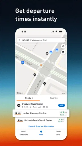
- Station and stop details make unfamiliar journeys easier to navigate
- Useful for checking disruptions before starting a commute
Cons
- Real-time data can occasionally lag behind actual vehicle arrivals
- Some features depend on a stable mobile data connection
- Large transit maps may feel cluttered on smaller screens
- Route planning may suggest lengthy transfers or indirect options
- Coverage is limited to Metro services and selected connected transit data
FAQs for LA Metro - Official
What is LA Metro - Official, and what can I use it for?
LA Metro - Official is the official mobile companion for Los Angeles County’s Metro transit system. It is designed to help riders plan journeys, check routes and schedules, find nearby stations, and stay informed about service changes. It can be useful for daily commuters, occasional visitors, and tourists who need guidance while using buses, trains, and other connected transportation services.
Does LA Metro - Official provide real-time arrival and service information?
The app is intended to provide current transit information, including estimated arrival times, route details, alerts, and service updates when data is available from Metro. However, arrival predictions can change because of traffic, vehicle delays, technical problems, or disruptions. For that reason, it is best to check the app shortly before leaving and allow extra time when traveling to an important appointment.
Can I use the app to plan a complete trip across Los Angeles?
Yes, LA Metro - Official can help you find routes between locations and understand which buses, trains, or transfers may be needed. It is particularly helpful in a large metropolitan area where a journey can involve several lines. Nevertheless, route suggestions should be reviewed carefully, especially late at night, during planned maintenance, or when temporary closures affect normal service.
Does LA Metro - Official support fares, passes, or mobile ticket purchases?
Depending on the current version and the services available in your area, the app may provide information about fares, passes, payment options, or connections with Metro’s official fare systems. Features can vary by device, account, and region, so users should read the fare instructions shown in the app before traveling. Always confirm whether a ticket or transit card must be activated separately.
Is LA Metro - Official free, and what permissions or connection does it require?
The application is generally available to download without an upfront charge, although normal mobile data costs may apply and transportation fares are not included. It may request location access to show nearby stations, improve trip planning, or provide location-based information. A reliable internet connection is recommended for live updates, while some basic route details may remain accessible when connectivity is limited.


